


 BACK TO GALLERY


Daniel Crouch Rare Books
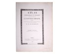
Alexander von HUMBOLDT
Essai politique sur le royaume de la Nouvelle-Espagne.
Presentation copy of a foundation work in the fields of political economy and economic geography.
Octavo volumes: 200 by 214mm. Atlas volume: 584 by 457mm.
description
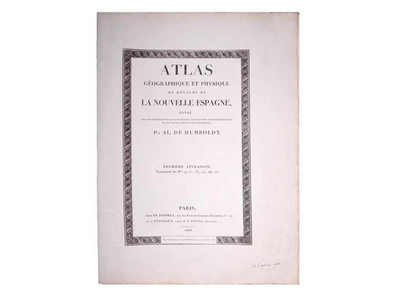
First edition, first issue of this atlas, with the first three livraisons with the earliest known title-page, dated 1808. The atlas was published to accompany the French edition of ‘Essai Politique sur le Royaume de la Nouvelle-Espagne’, but the atlas is sometimes found separately. The earliest edition of the text in German was published in Germany at Tubingen between 1809 and 1814, without the atlas. The present work was the third part of Humboldt's monumental ‘Voyage aux regions equinoxiales du Nouveau Continent fait en 1799-1804’, published at Paris (1805-1834) in over thirty volumes with about 1,200 engraved plates (and even then, the work still was not complete).
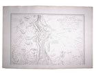
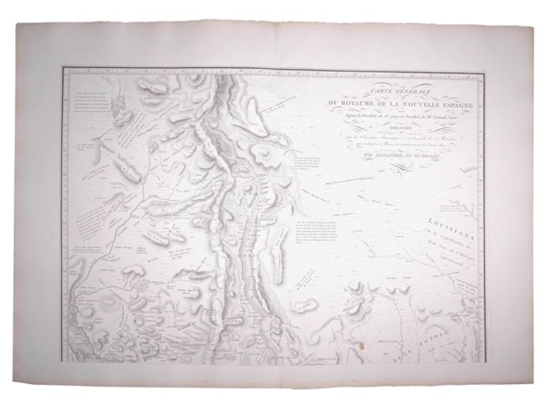
The most important map is Humboldt's great ‘Carte Generale du Royaume de la Nouvelle Espagne’, originally executed by Humboldt during his stay in Mexico in 1803-4, and covering two large folio double sheets. Wheat calls it a “truly magnificent cartographic achievement" and concludes that before the explorations of Lewis and Clark, Humboldt's maps were in the first rank of western cartography.
Schwartz and Ehrenberg state that it remained "the standard map of the Great Basin region until Fremont's explorations 35 years later".
Thomas Streeter discusses the map at great length, concluding that "it is without question the best representation of Texas that had thus far appeared". It is certainly one of the seminal maps for Texas and the Southwest.
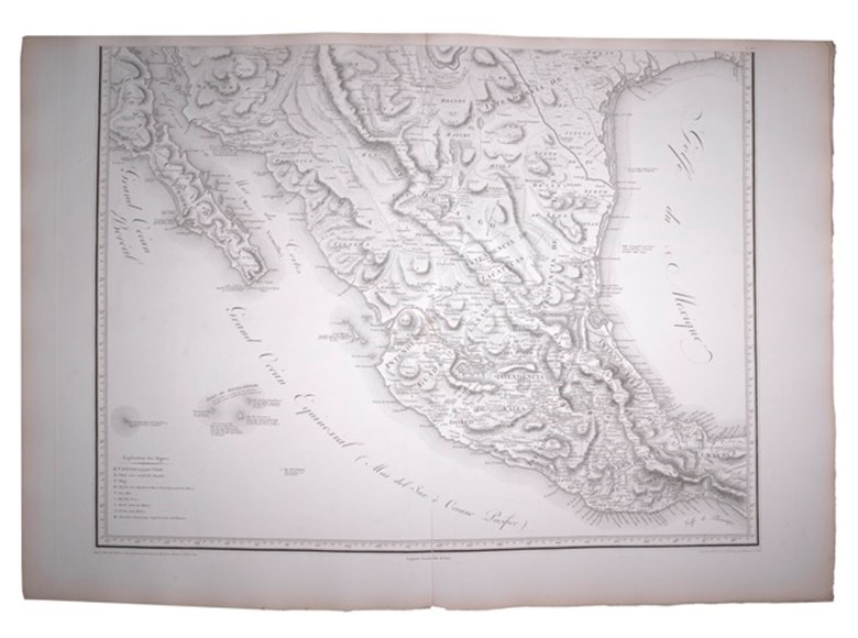
Besides the large map, there is a double-sheet map of the whole North American continent south of 42° latitude which reiterates Humboldt's western cartography on a larger scale, and three important maps for the Santa Fe trade illustrating the route from Mexico to Durango, Durango to Chihuahua, and Chihuahua to Santa Fe.
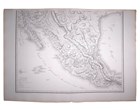
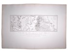
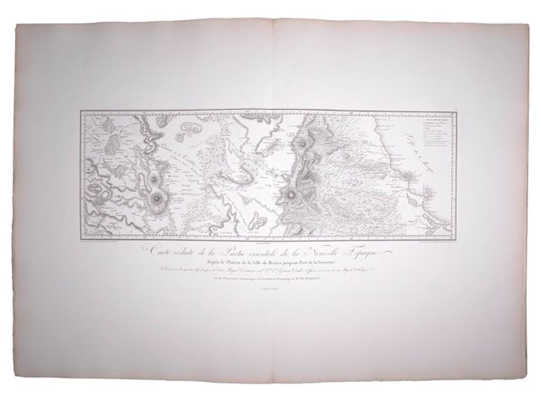
Other maps illustrate the Valley of Mexico, and ports and routes in Mexico and across the Isthmus. The Atlas concludes with a series of fine geological/physical profiles (most printed in sepia), and two excellent views of volcanoes, also in sepia.
Humboldt was described by Dibdin as the most illustrious traveller of his day. With the support of the Spanish Prime Minister, Humboldt managed to gain permission to enter the Spanish colonies of Central and South America, which were effectively closed at the time. He set off with the French botanist Bonpland from Marseilles in 1799, and spent five years travelling through Central and South America, during which time he covered some 6000 miles. He then returned to Europe and spent the next twenty-three years recording his experiences, observations and collections in a series of spectacular works. One of the first of these was the ‘Essai Politique...’, describing northern New Spain, particularly Mexico and the northern provinces, including California and the American Southwest. A most important work, here in its first published edition with the extraordinary addition of a presentation inscription in Humboldt's hand.
The most important map is Humboldt's great ‘Carte Generale du Royaume de la Nouvelle Espagne’, originally executed by Humboldt during his stay in Mexico in 1803-4, and covering two large folio double sheets. Wheat calls it a “truly magnificent cartographic achievement" and concludes that before the explorations of Lewis and Clark, Humboldt's maps were in the first rank of western cartography.
Schwartz and Ehrenberg state that it remained "the standard map of the Great Basin region until Fremont's explorations 35 years later".
Thomas Streeter discusses the map at great length, concluding that "it is without question the best representation of Texas that had thus far appeared". It is certainly one of the seminal maps for Texas and the Southwest.
Besides the large map, there is a double-sheet map of the whole North American continent south of 42° latitude which reiterates Humboldt's western cartography on a larger scale, and three important maps for the Santa Fe trade illustrating the route from Mexico to Durango, Durango to Chihuahua, and Chihuahua to Santa Fe.
Other maps illustrate the Valley of Mexico, and ports and routes in Mexico and across the Isthmus. The Atlas concludes with a series of fine geological/physical profiles (most printed in sepia), and two excellent views of volcanoes, also in sepia.
Humboldt was described by Dibdin as the most illustrious traveller of his day. With the support of the Spanish Prime Minister, Humboldt managed to gain permission to enter the Spanish colonies of Central and South America, which were effectively closed at the time. He set off with the French botanist Bonpland from Marseilles in 1799, and spent five years travelling through Central and South America, during which time he covered some 6000 miles. He then returned to Europe and spent the next twenty-three years recording his experiences, observations and collections in a series of spectacular works. One of the first of these was the ‘Essai Politique...’, describing northern New Spain, particularly Mexico and the northern provinces, including California and the American Southwest. A most important work, here in its first published edition with the extraordinary addition of a presentation inscription in Humboldt's hand.
 SEND AN EMAIL
 (212) 602 1779