


 BACK TO GALLERY


Daniel Crouch Rare Books
Thomas JEFFERSON
Message from the President of the United States.
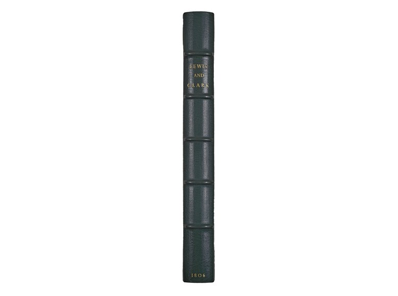
First edition, first issue, House of Congress printing, of the first account of the Lewis and Clark.
235 by 160mm.
description
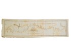
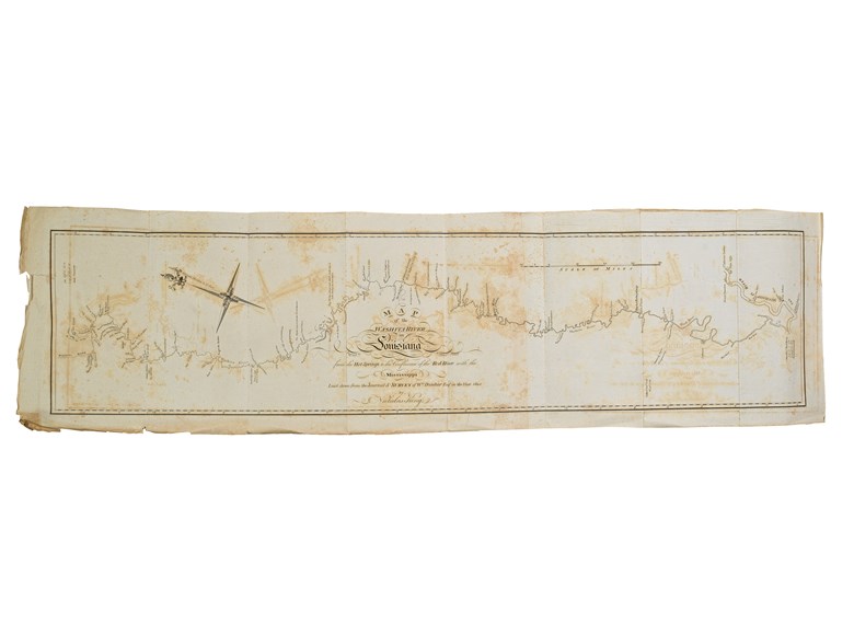
First edition, first issue, House of Congress printing, of the first printed account of the Lewis and Clark expedition. An exceptionally fine example, never bound, uncut and with the rare folding map, ‘Map of the Washita River in Louisiana from the Hot Springs to the Confluence of the Red River with the Mississippi Laid down from the Journal & Survey of W.m Dunbar Esq.r in the Year 1804 by Nicholas King’, loose and untrimmed with full margins, and unrecorded as such. “Read, and ordered to lie on the table” refers to the practice of leaving presidential communications out on the Speaker’s table “for promulgation by the Speaker” (Erickson).
Lewis’s report, sent from the temporary Fort Mandan, near the site of present-day Bismarck, North Dakota, begins with an account of the geological and botanical specimens that the exploring expedition have gathered, and forwarded to Benjamin Smith Barton of the Philosophical Society in Philadelphia. He also explains that he will “dispatch a canoe with three, perhaps four persons from the extreme navigable point of the Missouri, or the portage between this river and the Columbia river, as either may first happen. By the return of this canoe, I shall send you my journal, and some one or two of the best of those kept by my men. I have sent a journal kept by one of the sergeants, to captain Stoddard, my agent at St. Louis, in order as much as possible to multiply the chances of saving something. We have encouraged our men to keep journals, and seven of them do, to whom in this respect we give every assistance in our power”. He describes the non-military people in their party: “we have two interpreters, one negro man, servant to capt. Clark; one Indian woman [Sacagawea], wife to one of the interpreters, and a Manda man, whom we take with a view to restore peace between the Snake Indians, and those in this neighbourhood, amounting in total with ourselves to 33 persons”. He excuses himself for not having forwarded the accounts to the War Department in a timely manner… But most interestingly he makes an attempt to predict how the expedition will unfold in the coming months:
“As our vessels are now small, and the current of the river much more moderate, we calculate upon travelling at the rate of 20 or 25 miles per day, as far as the falls of the Missouri. Beyond this point, or the first range of rocky mountains, situated about 100 miles further, any calculations with respect to our daily progress, can be little more than bare conjecture. The circumstance of the Snake Indians possessing large quantities of horse, is much in our favour, as by means of horses the transportation of our baggage will be rendered easy and expeditious overland, from the Missouri to the Columbia river. Should this river not prove navigable where we first meet with it, our present intention is, to continue our march by land down the river, until it becomes so, or to the Pacific Ocean…” (page 7).
Thomas Jefferson (1743-1826) was president of the United States from 1800-1809. His “greatest triumph, and greatest defeat” (Merill D. Peterson for ANB) was the Louisiana Purchase of 1803. The Purchase breached the limits of the Constitution and Jefferson drafted an amendment to sanction the acquisition retroactively. “When it found no support in Congress, he buried his fears of making the Constitution a “blank paper by construction” (‘Jefferson Writings’, p. 1140) and proceeded with the treaty” (Peterson). The opportunity to properly explore the western regions of North American now became irresistible.
Jefferson involved his aide-de-camp and old Virginian neighbor Meriwether Lewis (1774-1809) in planning for this ambitious undertaking. In turn Lewis chose William Clark (1770-1838), a military comrade, to join him in leading the expedition. Early in July of 1803 Lewis “left Washington for the West and in the winter of 1803–1804 camped near St. Louis, across the Mississippi from the mouth of the Missouri. The exploring party of less than fifty men set off up the Missouri on 14 May 1804. Progress was slower than expected, and, after reaching the Mandan Indian villages, they spent the winter of 1804–1805” (Reginald Horsman for DNB), and from where he sent this report.
Exceptionally rare. Only 5 institutional examples with the map are known, at the LoC; the Newberry; the Missouri Historical Society; the Watkinson Library at Trinity College, CT; and the University of Pennsylvania. Only 4 examples have sold at auction in recent years: a damaged example was sold at PBA in 2007; the Siebert/Snider copy has appeared twice in 1999 and 2005; Mrs. Charles W. Engelhard’s copy sold at Christie’s in 1996, as part of a sammelband; and Streeter, 1966.
 SEND AN EMAIL
 (212) 602 1779